Noble Land Partners · Lawrence County, Missouri

2.5 unrestricted acres, already set up to use.

Wooded tract on a paved county road between Mount Vernon and Aurora. 30 and 50 amp power is already on site, the driveway is in, and there is a cleared campsite waiting. No zoning. No HOA. No restrictions.

Cash price
$34,900
2.5 acres · $13,960/acre
Or on terms
$12,000 down
30% down on a $40,000 financed purchase price

Off market. You are buying direct from us — no agent, no commission, no listing fee. The asking price is the price, and it all goes to the same place.

Parcel 137025000000010001 · County Road 2180, Mount Vernon, MO 65712 · Outline is generated from county parcel data and is approximate — it is not a survey.
Open the pin in Google Maps →

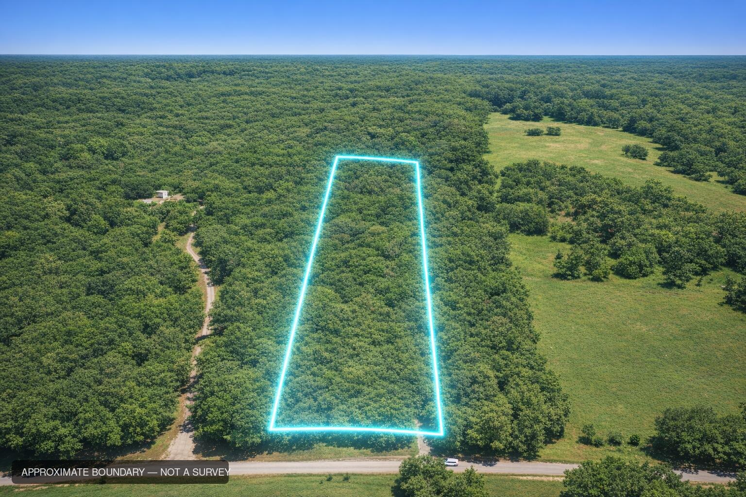
Drone photograph looking north over the tract, its boundary outlined, running back from County Road 2180 into mature timber with open pasture to the east.
Acreage
2.5
assessor
Road frontage
161 ft
paved CR 2180
Power
On site
30 & 50 amp
Zoning
None
no HOA either
Flood / wetland
0%
neither present
Annual tax
$135
2025 bill
The part most land doesn't have

Somebody already did the first year of work.

Most recreational land you look at is a line on a map and a wall of brush. On this one the utility is in the ground, the drive is cut, and there is a flat spot with a fire ring on it.

Power, underground

A 30 amp and a 50 amp hookup at the campsite, fed by an underground service from the pole at the road. No lines strung through your trees. Meter is on site.

🚗

Two drives, in and out

A main drive from the county road into the campsite with room to turn a rig around, plus a second drive that enters ten feet west of the southwest corner and loops back to the same clearing.

🔥

A campsite, not a plan for one

The clearing is already open — this tract has been used as a family camp twice a year for several years. Pull in, plug in, and you are camping the same afternoon.

🌲

Mature timber on three sides

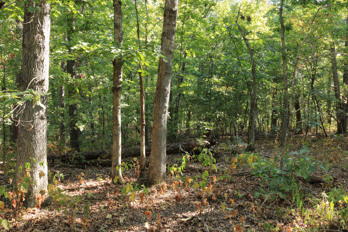
Heavy canopy across the whole tract, and the parcel sits on the corner of a much larger continuous timber block. Wildlife moves through it. You cannot plant your way into this.

🤫

Genuinely quiet

Under ten vehicles passed on a Saturday morning. One neighbor is visible from the road; the second is hidden in the trees. Birds and insects, and farm equipment somewhere far off.

💧

High and dry

The parcel sits at the top of the hill and sheds water away from itself. Zero flood zone, zero wetland. A shallow, rocky seasonal runoff creek forms the north boundary.

Photographed on site, 22 August 2026

What it actually looks like.

A photographer walked the whole tract on a Saturday morning and shot it straight — no filters, no staging, and the ugly parts left in.

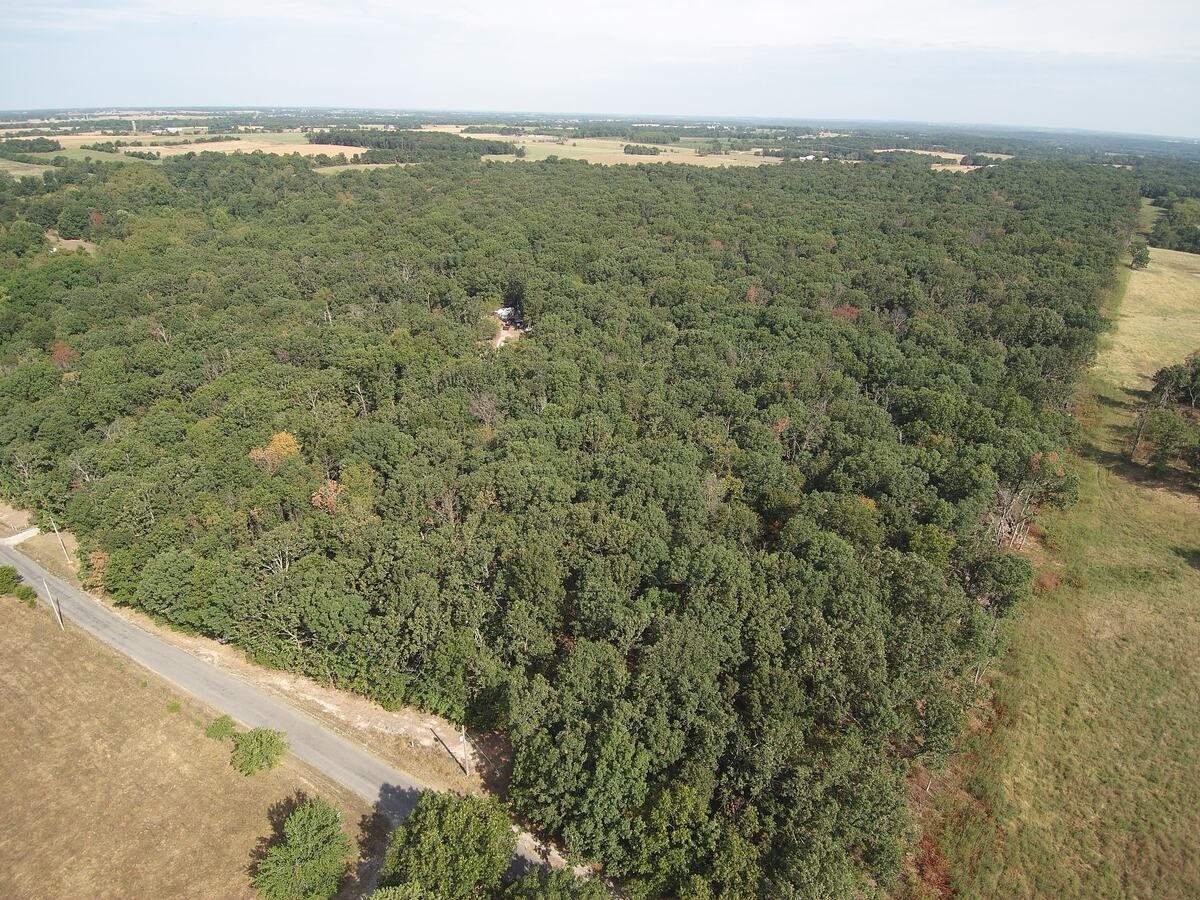
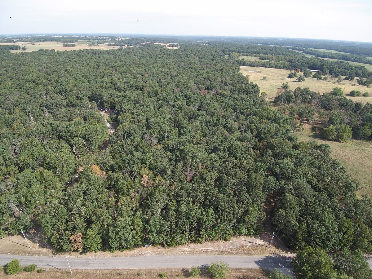
Aerial view over the timber block, the county road running along its southern edge.
Looking northwest. The tract runs north off the road, into the near edge of that timber.
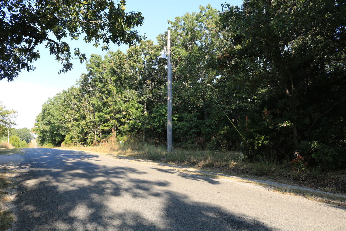
Paved county road running past the wooded frontage, power pole at the roadside.
161 ft of frontage on paved County Road 2180 — power pole at the road.
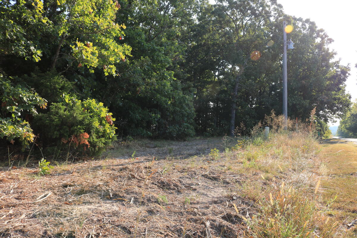
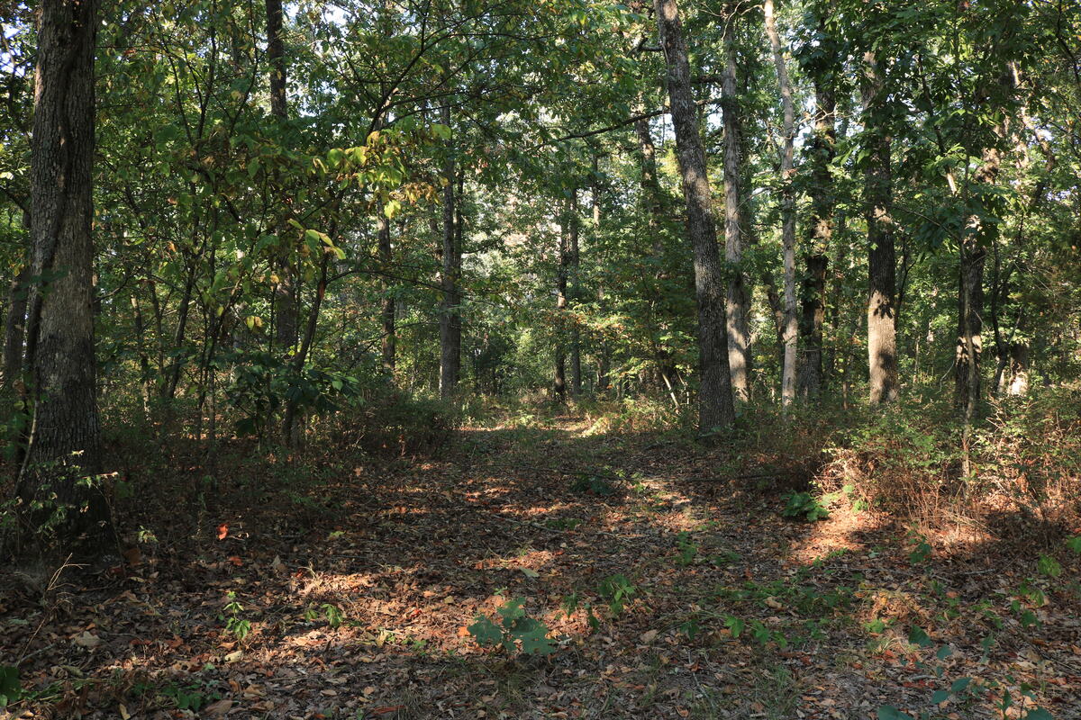
Cleared drive area under the tree canopy.
The main drive, in from the road with room to turn a rig around.
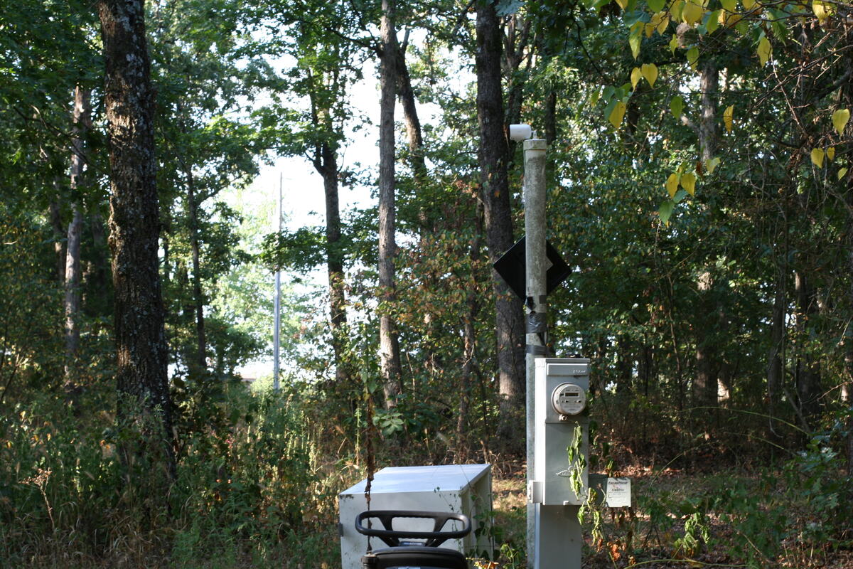
Electric meter and hookup pedestal standing at the campsite.
The meter and hookup pedestal at the campsite — 30 amp and 50 amp, fed underground.
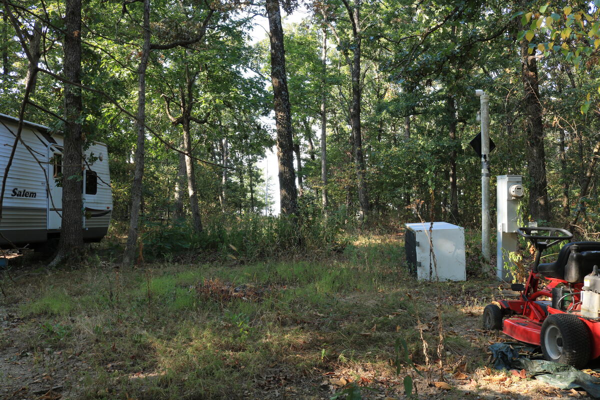
Cleared campsite with a travel trailer parked under the trees.
The cleared campsite. The camper, the refrigerator and the loose equipment all come off before the sale — none of it conveys.
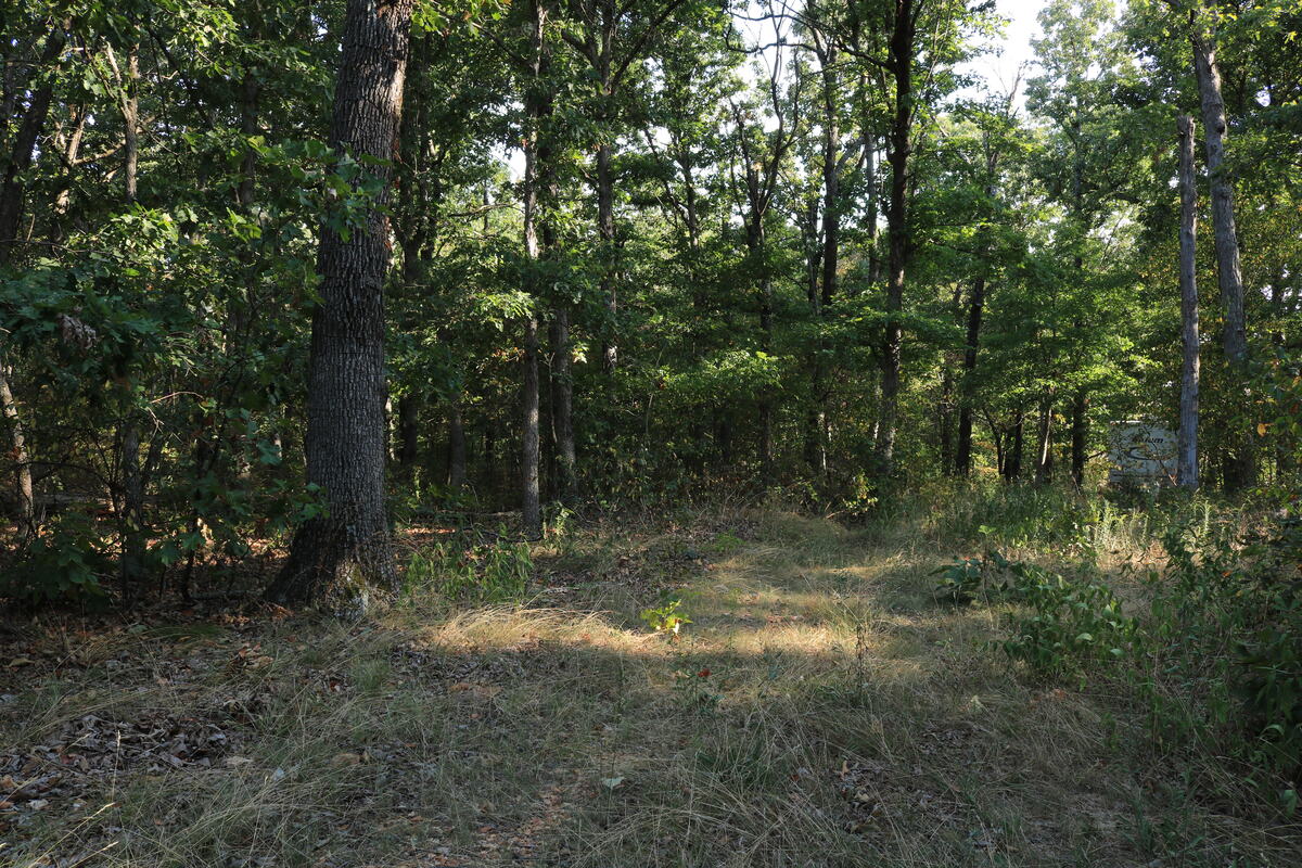
Open grassy clearing surrounded by mature trees.
Open ground around the drive — most of the level area sits in the south half.
Second drive track leading into the woods.
The second drive, entering about ten feet west of the southwest corner.
Mature hardwood trunks with sunlight through the canopy.
Mature hardwood through most of the tract.
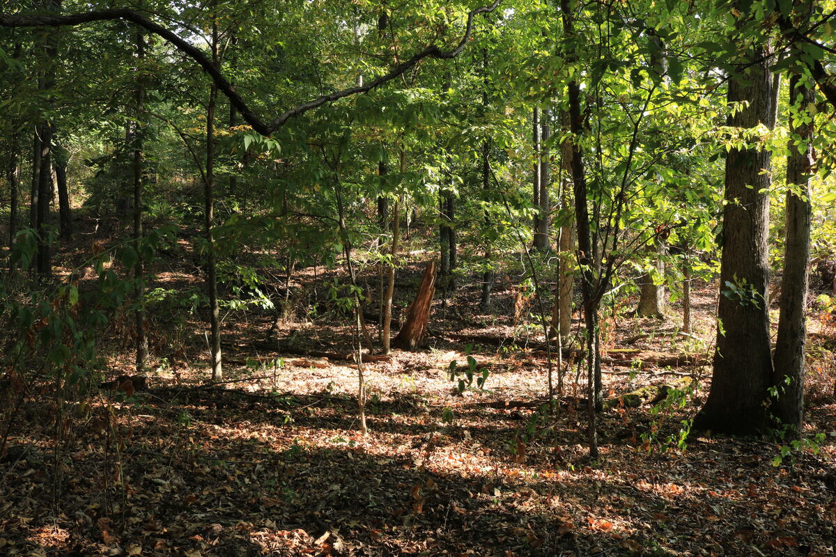
Dappled light on the forest floor between hardwood trunks.
Canopy gaps open up sporadically across the cleared areas.
Small natural clearing in the middle of the woods.
One of two smaller openings toward the north end.
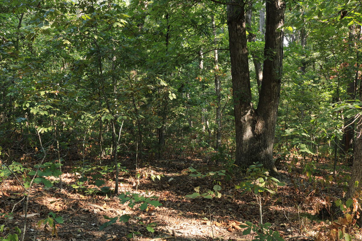
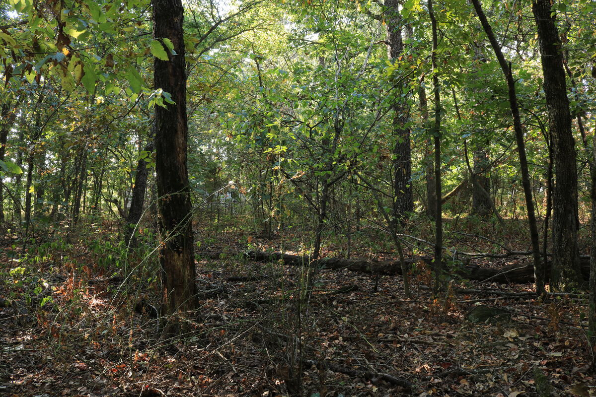
Wooded interior with leaf litter and understory growth.
Off the drives it gets thick — this is the honest version of the interior.
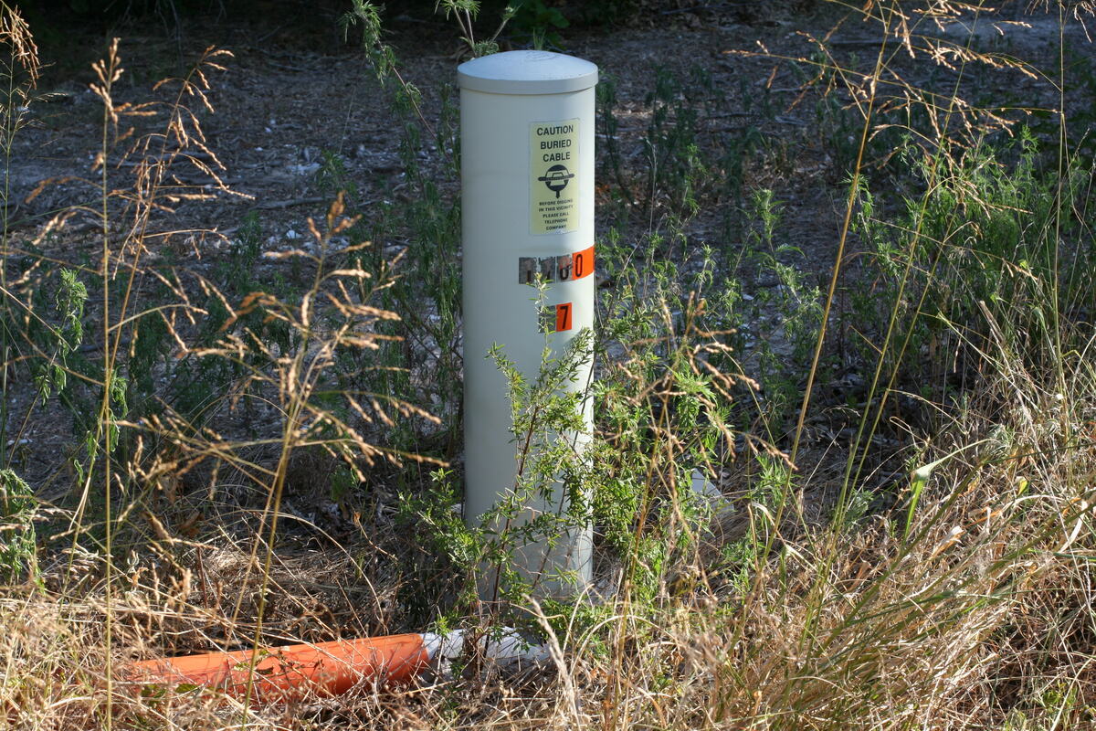
Utility marker post in the grass at the roadside.
Data or phone line marked at the road.
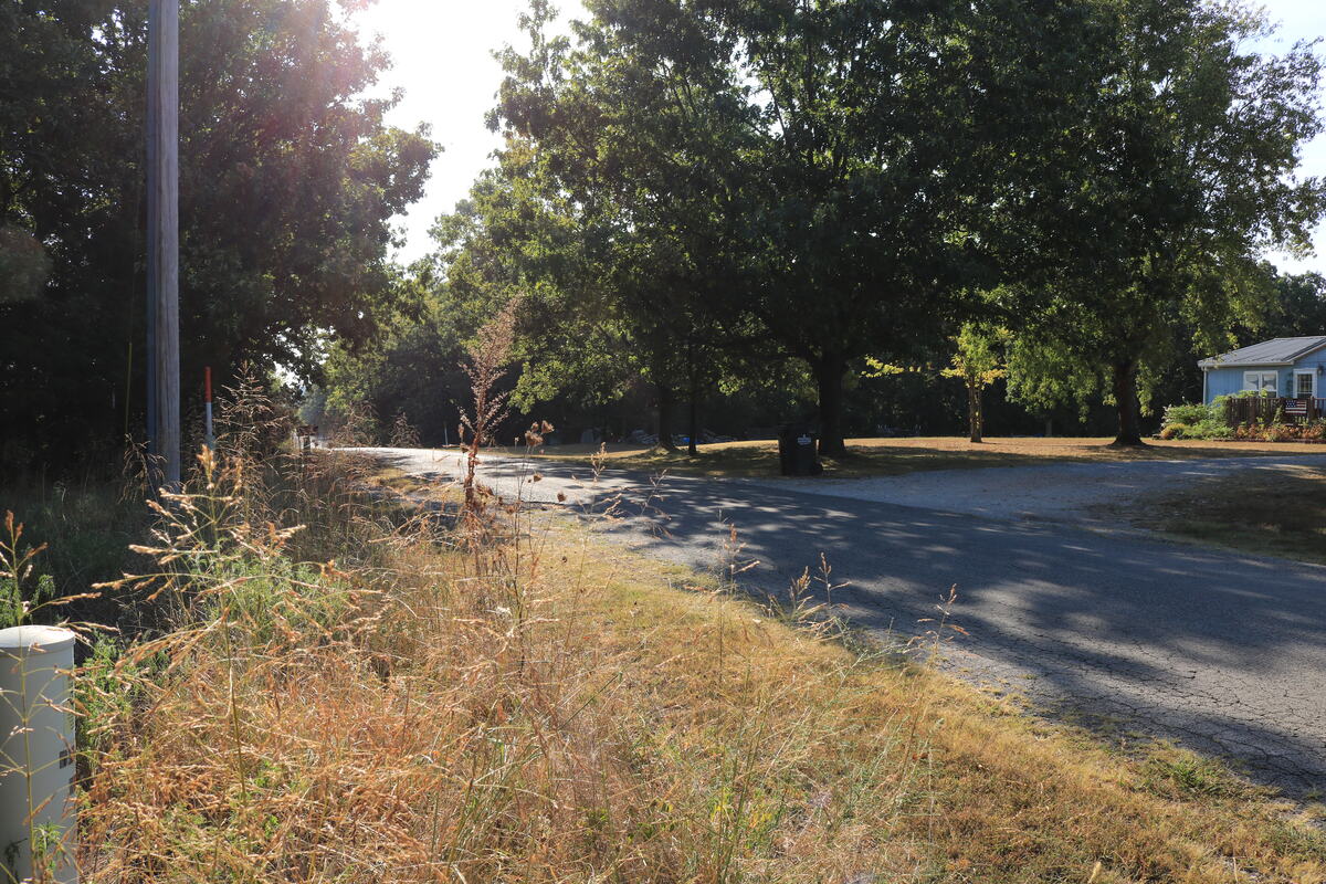
View along the paved county road with a neighbouring house in the distance.
Looking down CR 2180. Under ten vehicles passed all morning.
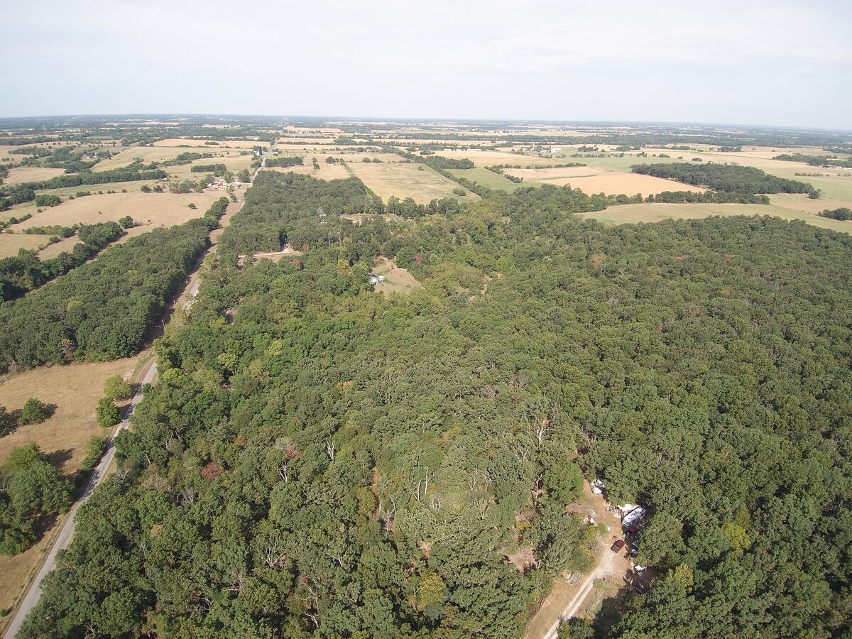
Aerial view south over unbroken timber with farmland on the horizon.
The timber runs a long way. That is why there is wildlife on two and a half acres.
Aerial view of the county road cutting between timber and open farmland.
Timber on one side of the road, open farm ground on the other.
The shape of the ground

Flat where you'd build. Falls away at the back.

We sampled USGS elevation every twenty-three feet down the middle of the tract, from the county road to the north boundary. It is not a gentle guess — it is the actual profile.

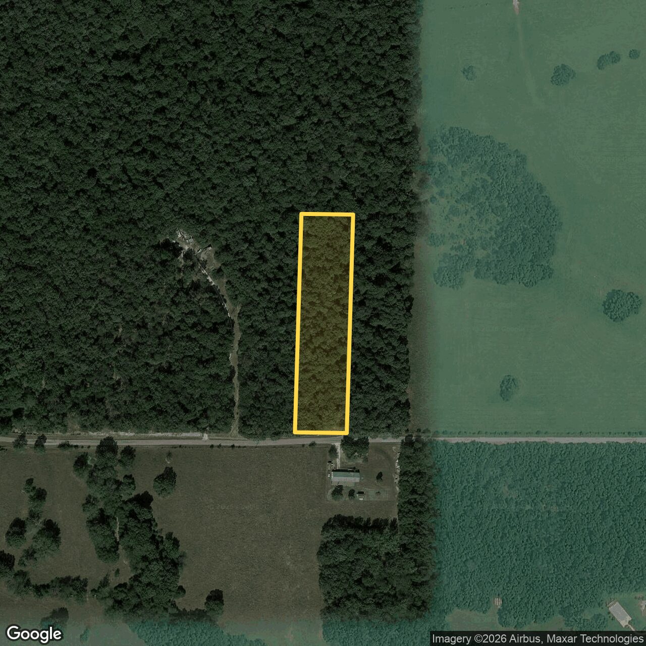
Satellite view with the parcel boundary outlined in yellow, a narrow strip running north from County Road 2180.
The tract on satellite, straight down: 161 ft of frontage on the county road, about 675 ft deep, mature timber the whole way. Open farm ground begins a short way east; the big timber block runs west.
1280129013001310 ft Level building ground — first ≈350 ft, 2.3% grade County Road 2180 ← about 675 ft deep → North boundary
  • The first 350 feet barely moves. Eight feet of fall across the whole front third — a 2.3% grade. That is the flattest, most usable ground on the tract, and it is the part closest to the power and the drive.
  • Then it steps down. Past the halfway mark the grade steepens to roughly 9%, dropping about twenty-three feet to the low corner.
  • Thirty-one feet of relief, total. High point 1,309 ft at the road, low point 1,279 ft near the north-east corner where the seasonal runoff creek runs.
  • Water leaves, it doesn't collect. The tract sits at the top of the hill and sheds north and east. No standing water anywhere on it at inspection, no flood zone, no wetland. The seasonal drainage at the low corner is not a mapped stream — it appears neither on the USGS 7.5-minute quad nor in the National Hydrography Dataset.
The question everybody asks

You can build on almost anything. The question is what it costs.

There is no zoning here and no prior septic to inherit, so nothing forbids a build. What varies from one tract to the next is the bill — and on this one, the number that moves is the wastewater system. Which system you need is decided by a soil pit, not by us. Here is everything that bears on that, including what is still open.

Already bought and paid for

Electric run underground to a meter and a 30/50 amp hookup. A drive cut from the road with room to turn around. A cleared site. On raw ground those are the first three cheques a buyer writes, and here they are behind you.

💰

The number that actually moves

The septic system. A conventional gravity field is the cheap end and the common outcome here; an advanced system is the expensive end. A soil scientist reading a four-foot pit is what decides which — and Missouri pricing for that read is a fraction of what the same work costs in the Carolinas.

🚰

Then the well

There is no public water here, so a well is a cost of building rather than an open question. Several drillers work Mount Vernon, Aurora and Verona. Depth is what drives that price on cherty Ozark ground.

What the county told us

  • There is no zoning here. Lawrence County has no county zoning outside the towns. Stick, modular, manufactured, barndominium — the county does not restrict it, and the deed carries no restrictions or HOA.
  • No septic has ever been permitted on this tract, and no failed application exists. We had the health department pull the inventory on this address and the neighbouring ones. We asked about septic history only — we have not researched well records.
  • Missouri does not perc-test here. Lawrence County evaluates by soil morphology — a registered soil scientist digs a four-foot pit and reads the horizons to derive a loading rate directly.
  • Under three acres means a county construction permit is required for any new system — the ordinary path here, not an obstacle. The health department publishes lists of registered installers, soil scientists and pumpers.
  • The county permits roughly 150 systems a year. About fifteen need an advanced system, and roughly half of those are driven by tight lot geometry rather than bad soil — leaving on the order of five to seven percent that fail on soil alone.

What our soil screen found

  • Two soil units, both typical cherty Ozark upland. The front two thirds, including all the road frontage, is Wilderness gravelly silt loam — mapped as ridge summit and crest, convex, the landform position that sheds water rather than collecting it. The north third is Nixa-Clarksville complex, mapped as hillslope backslope, and the desktop screen rates it the stronger of the two units.
  • The county has a field evaluation on file for a Nixa soil at 0.45 gallons per day per square foot. At that rate a three-bedroom conventional gravity field needs roughly 800 square feet of trench, plus an equal reserve — that fits here comfortably.
  • Wilderness carries a real limitation — a fragipan modeled at 15 to 29 inches. Missouri's standard answer is shallow-placed trenches above the restrictive layer. It could push the design, but it is not a disqualifier.
  • Desktop verdict: moderate-high, favorable pending evaluation. Buildable-area score 70 out of 100.
How a build lays out here

The tract is a narrow strip — roughly 150 feet wide and about 675 feet deep — so a build here runs along its length rather than across it: a house, a well, a drainfield and its reserve area, arranged front to back. A well has to hold separation from a drainfield, which on a lot this shape is a question of layout more than of soil.

The arrangement the ground suggests is well toward the front, house in the middle, system at the back. A registered soil scientist reading a pit on site is what settles it — where the system goes, where the well sits relative to it, and therefore what the whole thing costs. That read is normally the buyer's to order and pay for, as part of their own diligence.

And if you just want to use it

None of this is in your way. A well and a septic system are what a house needs — they are not what camping needs. The hookup, the drive and the cleared site are there now, so you can pull in this weekend and sort the rest out whenever, or never.

None of the above is a permit, and a desktop screen is not a soil evaluation. We have published what we found so you can budget before you spend a dollar on field work — but the evaluation, the system and the well are the buyer's to commission and pay for, and we have priced the tract that way. We are gathering installer, driller and soil-scientist quotes now and will publish the numbers here as they come in.

Everything we know, including what we don't

The due diligence, published.

Most land listings tell you what is good. This is the whole file — verified, in progress, and open — so you can price the unknowns yourself instead of discovering them after closing.

ItemStatusWhat we found
Legal accessVerified161 ft of frontage on County Road 2180, a maintained paved county road. Not landlocked.
Physical accessVerifiedMain drive in place from the road to the campsite; room to turn a camper. Entry is unfinished — no culvert or ramp, with a shallow drainage ditch between road and drive. The road crowns at the entry and drainage runs away from the parcel.
ElectricVerifiedPole at the road, meter at the campsite, service run underground. 30 amp and 50 amp hookups. Account transfer is the buyer's to arrange.
TelecomVerifiedData or phone line visible at the road.
ZoningVerifiedNo county zoning. Septic permitting is the only land-use gate. Outside city limits.
HOA / restrictionsVerifiedNone of record. No subdivision, no HOA, no deed restrictions found.
Flood & wetlandsVerified0% flood zone, 0% wetlands. Elevation 1,274–1,310 ft; the tract sits at the top of the hill. The seasonal drainage near the low corner is not a mapped stream — absent from both the USGS 7.5-minute quad and the National Hydrography Dataset.
Prior septic recordVerifiedLawrence County Health Department has no application, permit or failure on file for this tract — nothing to inherit and nothing to remediate. The county ordinance dates to 1996. Septic only; we did not ask about well records.
Soil screenVerifiedDesktop USDA-NRCS screen completed 8/25/2026: moderate-high, favourable pending field evaluation. Buildable-area score 70/100. Published on this page in full — a desktop screen, not a soil evaluation.
TopographyVerifiedUSGS elevation sampled every 23 ft along the centreline: 1,309 ft at the road, 2.3% grade across the first 350 ft, then falling to 1,279 ft near the north-east corner. 31 ft of relief across the whole tract.
Site inspectionVerifiedFull walkthrough and professional photography on 8/22/2026. Notes on terrain, cover, drainage, utilities and negatives are summarized on this page.
TaxesVerified$135 for 2025. Any arrears are the current owner's responsibility and are cleared at closing.
Soil evaluation bidIn progressGetting quotes from registered Lawrence County soil scientists so you know the cost before you commit. The evaluation itself — a four-foot pit, read on site — is the buyer's to order; that is the normal path here, and Missouri pricing is a fraction of what the same work costs east of here.
Septic bidIn progressQuotes being gathered from county-registered installers working Mount Vernon, Aurora and Verona.
Well bidIn progressQuotes being gathered from drillers serving this area. No well on the tract today.
Well sitingOpenNo well on the tract yet, so its position is still yours to choose. Where it sits relative to the drainfield gets set on site by your driller and soil evaluator — routine on a lot this shape. We have not researched neighbouring well locations.
SurveyOpenNo survey exists, and none is required to close. Boundaries are mapped from county parcel data and corners are not staked. Tracts this size trade without one all the time here — if you want one, order it at your expense.
Second exitOpenA second drive loops out onto the adjoining drive and has been used that way. We have not confirmed it as a recorded easement in the title work, so we are not selling it as one — treat the county road frontage as your access.
Water serviceVerifiedThere is no public water here — a well is required. No meter and no waterline marker anywhere on the tract or at the road, and no well on the property today. Treat a well as a cost of building, not an open question.
Please read this

Everything above is what we found, published so you have somewhere to start rather than nowhere. It is not a substitute for your own due diligence, and you should not rely on it as one. Buyer is responsible for independently verifying acreage, boundaries, access, utilities, soil and septic feasibility, well feasibility, zoning, title and anything else that matters to your plans, before closing. Where we say "verified" we mean we checked it and are telling you what we were told — not that we warrant it.

Read this part twice

What you are also buying.

Every one of these came out of our own walkthrough. None of them killed the deal for us, but you should know them before you drive out.

It is thick

Heavy canopy with thorned vines and ivy, both the poisonous and the harmless kind. Walking is easy around the drives and campsite and fair-to-poor everywhere else; the east side is more passable than the west. Clearing beyond what is already open means equipment or a lot of Saturdays.

There is some trash

Minor scrap and litter around the campsite and the frontage, over and above the camper and gear that come off before the sale. Call it a day's work with a trailer.

The back quarter drops

The north end falls away to a low point at the northeast corner, bounded by a shallow rocky runoff creekbed. Average slope across the tract is about 7%, with pockets steeper than that.

No water, no septic, and the camper goes

There is no well and no septic system today. The camper, the refrigerator lying out by the campsite and the rest of the loose equipment all come off before the sale and do not convey — what you get is the hookup, the drive and the clearing.

Why $34,900

What small tracts around here actually sell for.

Every recorded vacant-land sale within about fifteen miles, three acres and under, over the last eighteen months. We opened all eleven listings and went through every photograph, because a price with no idea what was being sold is just a number. Sorted by what was actually on the ground.

SoldWhereAcresPrice$/acreDaysWhat the listing photos show
This tractCounty Road 2180, Mount Vernon2.5$34,900$13,960Power to a meter and 30/50 amp hookup, two drives, cleared campsite, mature timber
Bare rural tracts — the closest thing to a like-for-like
Jul 2025Stonegate Subdivision, Ash Grove · 13 mi2.58$13,500$5,233990Platted subdivision with stone entrance pillars. The lot itself is brushy open ground.
Oct 2025Private Road 1195, Aurora · 14 mi1.00$14,900$14,900136Small wooded lot on a private road. Gravel drive, pond nearby.
May 2025Lawrence 2194, Freistatt Twp · 4 mi2.96$25,000$8,44620Wooded lot inside a named subdivision. No power or drive visible on the lot.
Sep 2025Lawrence 1224, Buck Prairie Twp · 10 mi2.16$29,900$13,84310Open mowed pasture with road frontage and houses nearby. No timber, no structures.
Feb 2026Lawrence 2105, Mount Vernon · 8 mi1.68$34,000$20,2384Open ground beside a pond. One map image only — we could not verify improvements.
Town or subdivision lots — serviced ground, different product
Apr 2026Elm Street, Pierce City · 10 mi1.43$34,900$24,40646In-town platted lots on a street grid. Plat drawing and parcel map only.
Mar 2026Ballpark Rd, Pierce City · 10 mi1.74$37,500$21,552195In-town, mowed, shade trees, paved street on two sides, power lines along the street.
Jul 2025Edina Ave, Purdy · 14 mi3.10$50,000$16,1298A large lot inside an established in-town neighbourhood — houses on every side.
Feb 2026Brandermill, Monett · 9 mi1.10$50,000$45,455225Subdivision lot with paved, curbed streets.
Already improved, or not residential at all
Oct 2025Lawrence 1112, Mount Vernon · 8 mi1.70$45,000$26,47129Septic already in the ground — tank lids in the gravel — plus an electric pedestal, gravel drive and an outbuilding.
Apr 2025Hayward Drive, Mount Vernon · 5 mi1.00$50,000$50,000108Commercial ground at the I-44 interchange. Highway frontage, concrete apron. A different market entirely.
The pattern, stated plainly

Every sale we could verify above $37,500 had something extra on it — town services, subdivision streets, a septic system already in the ground, or commercial highway frontage. Bare rural tracts in this radius traded between $13,500 and $34,000. We are priced below the line where everything else needed town water or an existing system to get there.

Against that bare-ground band, $34,900 is $900 above the highest of them — and per acre, $13,960 sits within about a hundred dollars of the $13,843 median those five tracts traded at. So you are paying roughly bare-ground money per acre, on a tract that already has electric run underground to a meter and a 30/50 amp hookup, two drives, and an open site. None of those five had any of it.

For what that work is worth to this market: the 1.7-acre place on Lawrence 1112, with a septic already in the ground and an electric pedestal, took $26,471 an acre — nearly double what bare pasture nearby brought. And cheap is not the same as sellable; the lowest-priced tract in that table sat 990 days.

Where it is

Halfway between Mount Vernon and Aurora, a little to the west.

  • Verona — about 5 miles
  • Mount Vernon — about 7 miles, county seat, I-44 interchange
  • Aurora — about 8 miles
  • Monett — about 9 miles
  • Springfield — about 35 miles
  • Joplin — about 40 miles
  • Table Rock Lake / Branson — about 40–45 miles south

Distances are approximate. School district is Verona R-VII.

The pin drops on the road frontage. If your phone would rather have numbers, the coordinates are 37.015659, -93.839710 — paste them straight into Maps or a GPS. There is no mailbox and no house number at the road, so navigate to the pin, not to an address.

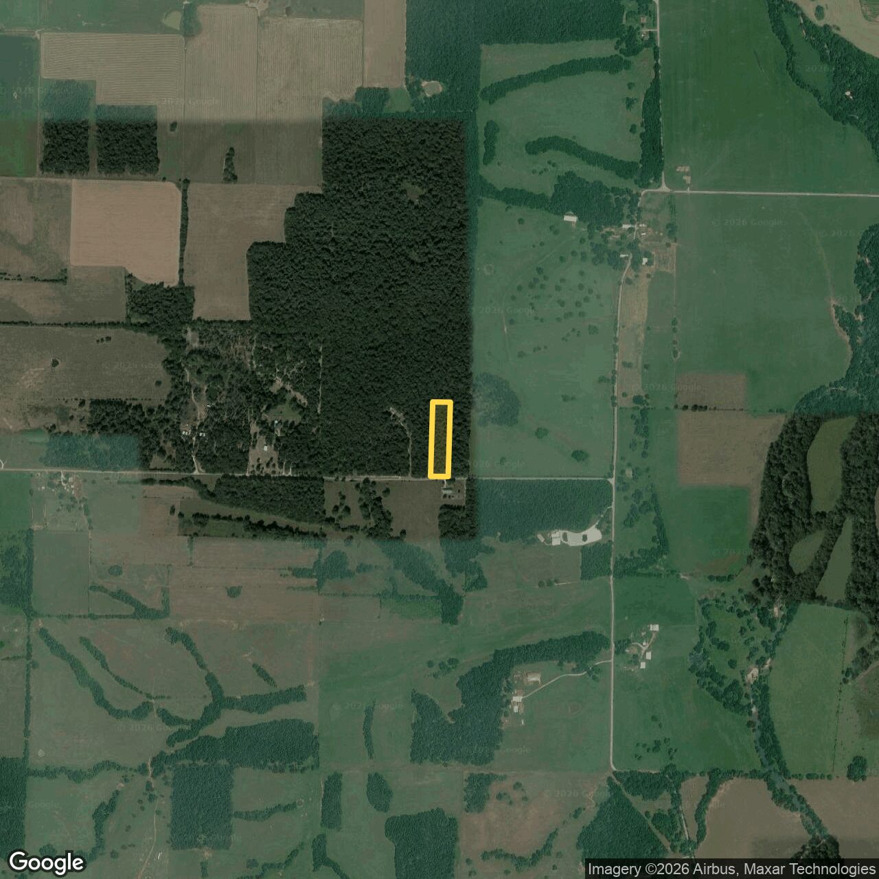
Wider aerial showing the parcel on the southeast corner of a large continuous timber block, with farmland to the east and south.

The tract sits on the corner of a large unbroken block of timber — the reason there is wildlife moving through a two-and-a-half acre parcel.

Two ways to buy it

Cash, or 30% down and financing is arranged.

Cash
$34,900
Clean and quick
On terms
$12,000 down
30% down on a $40,000 financed purchase price. No bank and no income verification.

This is an off-market sale — no agent, no commission and no listing fee, which is part of why the number is what it is. On terms there is no bank application and no income verification, though we do run a credit check. The financing is arranged through a private investor — the note is assigned at closing, so your payments go to them rather than to us. You still buy the land at closing either way. Come walk it; bring a tape measure and a shovel if you like. If you are the sort of buyer who reads the whole due-diligence table before calling, you are the sort of buyer we would rather sell to.

980-350-9505

Noble Land Partners LLC · Parcel 137025000000010001, Lawrence County, Missouri · 2.5 acres per the assessor · Legal: S1/4 E1/2 E1/2 SW SW, Sec 25 Twn 27 Rng 27.
Acreage, boundary lines and distances shown are taken from county parcel data and aerial imagery, not from a survey, and are approximate. Soil information is a desktop screen of modeled USDA-NRCS map-unit data and is not a certified soil evaluation, a percolation test or a permit; no pit has been dug on this parcel. Nothing on this page is a guarantee that any onsite wastewater system, well or structure will be approved. Comparable sales are recorded third-party data believed accurate but not warranted. Buyer is responsible for conducting their own due diligence and independently verifying every fact on this page before closing; no statement here is a representation or warranty, and nothing on this page should be relied upon in place of your own investigation, inspections and professional advice. Noble Land Partners LLC sells land for its own account as a principal — we are the seller, not a broker or agent, we do not represent any buyer, and we hold or are acquiring the interest being conveyed. Owner-financed terms are subject to credit approval and to a written agreement, and the note is assigned to a third-party investor at closing; the figures shown are indicative, and nothing here is an offer of credit or a commitment to lend.